


 54-55 / 160

55
www.adams.ieThe R.S.J.Clarke Collection of Cartography
15
th
December 2015
Joseph Huddart was born on 11th January 1741 at Allonby, Cumber-
land,where his father was a shoemaker and farmer. He was educated at a school kept
by a local vicar, and early on showed an aptitude for mathematics and mechanics, and
constructed a model water-mill and 74-gun warship. When he left school he went to sea
for a fish-curing business in which his father had engaged, and when his father died in
1762 he took command of their brig. In 1768 he built another brig and while commanding
these began to study navigation and to survey the ports he visited.
In 1771 Joseph Huddart came into contact with cousins in London who had
connections with the East India Company. On their introduction he entered the service of
the Company and in 1778 was appointed commander of the ship Royal Admiral. He made
four voyages to the east in this ship, continuing to survey whenever possible. In this peri-
od he produced charts of Sumatra and the west coast of India, the former being published
in 1778 by the firm of Sayer and Bennett.
Even while he was with the Company, Huddart in 1777 was commissioned
by Sayer and Bennett to make a new survey of St. George’s Channel and also carried out
surveys for them in Ireland and the west of Scotland between voyages to the far east. His
manuscript survey of the Irish Sea, dated 1778, is in the British Library. An overall chart of
this area was published by Sayer and Bennett in 1779, and his other charts of Ireland and
the Hebrides came out over the next ten years. He resigned from the East India Company
in 1788 and continued surveying in the west of Scotland for the next three years. In 1791
he was elected an elder brother of Trinity House and a Fellow of the Royal Society.
112
Joseph Huddart
A Chart of the West Coast of Ireland from Shannon to Urris
Laurie & Whittle (1794). 525 x 775
€ 300 - 500
113
Joseph Huddart
A Chart of the North Coast of Ireland
Laurie & Whittle (1794). 795 x 525
€ 300 - 500
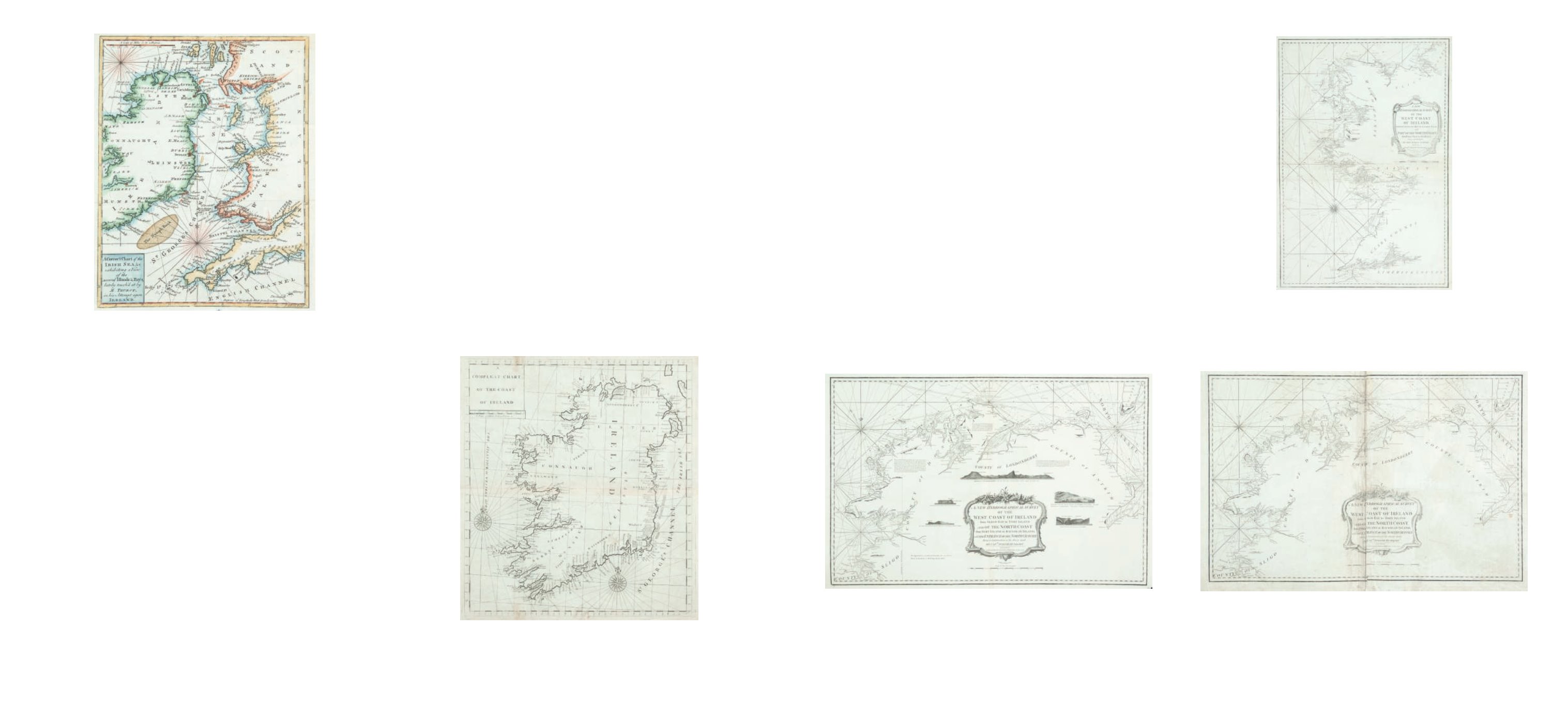
111
Joseph Huddart
A Chart of the North Coast of Ireland
Laurie & Whittle (1794). 795 x 525
€ 300 - 500
109
John Gibson
A Chart of Ireland and the Irish Sea
Gentleman’s Magazine (1760).
180 x 240
€ 50 - 100
John Gibson was a geographer, draughtsman and engraver of maps and charts from
about 1750 to 1792, at No. 18 George’s Court, Clerkenwell, London. He engraved maps for
Salmon’s Universal Traveller, 1752-1753; Jean Palairet’s Atlas Methodique, 1755 (including
a map of Ireland which exists in two states); The Gentleman’s Magazine, 1758-1766; The
Grand Magazine of Magazines, 1759; Atlas Minimus (with Bowen), 1758; The Counties of
England and Wales, 1759; The American Gazetteer, 1762; Speer’s The West India Pilot,
1771; and many other single maps. (Chubb, 1927; British Museum Catalogue).
The chart of Ireland and the Irish Sea is based on a typical map of the period
and is drawn to illustrate an anonynous account of Thurot’s life and expedition round Brit-
ain, published in The Gentleman’s Magazine, March 1760, pp. 107-112. There is another
acount of him by Patterson (1873), but the definitive biography is Captain Francois Thurot
by Young and Foster (1986). Stories of Irish ancestry and nobility, etc., etc., appear to be
false. Francois T hurot’s father was also Francois, born in Orleans, who moved to Nuits (St.
Georges) as a post-master and wine merchant. By his wife Honnete Michelle Chaumonet
he had 14 children, of whom only 3 survived. The eldest survivor was Francois who was
born in Nuits on 21 July 1727 and brought u p at home until after his father died when he
was only eleven. He spent much of his early life as a smuggler and adventurer but was
always brave and courteous. Finally, he recieved help and preferrment from the wealthy
Boulogne family of Tallard and narrowly escaped justice in 1759 to become commander of
the Belleisle in a five-ship squadron to raid British shipping. They sailed round the north
of Scotland and had been reduced to three ships when they landed at Carrickfergus on 21
February 1760. They easily captured the town and castle under Col. Jennings, obtained
stores a nd set sail again. In the meantime Capt. Elliott commanding the Aeolus had come
up from Kinsale with two frigates. They engaged Thurot’s ships on the 28th February and
in the action Thurot was killed. The Carrickfergus landing is also described by the Rev.
John Wesley who arrived there in May of that year, and heard detailed accunts from those
involved, including a Mrs. Cobham in whose house Thurot had stayed.
Edmund Halley was born in London on 29th October 1656, the son of
Edmund Halley, a prosperous soap manufacturer (D.N.B. XXIV, 104). He was educated at
St. Paul’s School. London, under Dr. Thomas Gale, and in 1673 entered Queen’s College,
Oxford, graduating M.A. in 1678. He studied astronomy from his schooldays and in 1676
published a paper on the planetary orbits. In November of the same year he embarked
for St. Helena to make observations on the stars of the southern hemisphere and was
elected F.R.S. in 1678. He published many books and papers on astronomy, was appoint-
ed Savilian professor of geometry at Oxford in 1703, and became Astronomer Royal in
1720 in succession to John Flamsteed.
In the cartographic field he compiled in 1688 the first authentic meteorologi-
cal chart of the world, which was published in the Philosophical Transactions of the Royal
Society. Between 1698 and 1700 he commanded the Paramour in scientific research in
the North and South Atlantic. He also produced a chart of the English Channel in 1702,
published magnetic charts of the Atlantic in 1701 and of the World in 1702 and a map of
Surinam in 1733. He died on 14th January 1742.
Halley was largely responsible for the maps and charts in the Atlas Maritimus
et Commercialis of 1728, and the chart of Ireland, though unsigned, is usually attributed
to him. The volume contains an extensive description, probably by Daniel Defoe (Moore,
1 956), of the countries of the world including Ireland (pp. 21-25) and sailing directions
by Nathaniel Cutler, Ireland being pp. 19-26. The main part of the volume consists of “a
Sett of Sea Charts, some laid down after Mercator, but the greater Part according to a New
Globular Projection Adapted for measuring Distances (as near as possible) by Scale and
Compass, and Authorized by Letters Patent under the Great Seal of Great Britain. The Use
of the Projection Justified by Dr. Halley ....”. It is a large folio volume, printed for James
and John Knapton and other leading booksellers of London.
110
Edmund Halley
A Complete Chart ... of Ireland
From the Atlas Maritimus 1728.
502 x 577.
€ 200 - 300
Edmund Halley
Joseph Huddart