


 76-77 / 160

77
166
Huddart
Chart of the Shannon Estuary
The title is in an oval frame in the lower right corner and reads
“A New and Exact Hydro-
graphical Survey of the River Shannon; from Limerick to the Sea, with all the Banks, Shoals,
Rocks, Channels, Soun dings, Anchoring Places, &c.” Within the frame also is a “Scale of Two
Leagues or Six Miles 6 [= 142 mm.]” and the imprint “London. Printed for Robt. Sayer and
John Bennett, Fleet Street, as the Act directs 14 April 1781”.
This chart was prepared by Joseph Huddart in 1781 for Sayer and Bennett (Robinson,
1962; B.L. Catalogue), though it is not signed by him. It is printed on three sheets joined
side by side.
1,560 x 725 mm.
€ 300 - 400
168
Huddart
Chart of the North Coast of Ireland
The title is is a scalloped frame in the bottom centre and reads
“A New Hydrographical Survey of the
West Coast of Ireland from Sligo Bay to Tory Island and of the North Coast from Tory Island to Raughlan
Island; with the Entrance of the North Channel Being a Continuation of the Survey made by Captn. Joseph
Huddart. London. Printed for R. Sayer & J. Bennett, Fleet Street, as the Act directs 19 Septr. 1781”.
This chart was first published in 1781 by Sayer and Bennett and was included in their East India Pilot of
that year. It was reprinted in 1794 by Laurie and Whittle for their Irish Coasting Pilot and Coasting Pilot
of Great Britain and Ireland. It was reprinted again in 1812 and in this form was included as the fifth
chart in Laurie and Whittle’s The North-about Navigator of 1818.
795 x 525 mm.
€ 300 - 400
169
Huddart
Chart of the N.E. Coast of Ireland
and S.W. Scotland
The title in a scalloped frame in the top
right corner reads
“A New Chart of the West
Coast of Scotland From the Mull of Galloway
to Dunan Point in Sky; including the Western
Isles of Ila, Jura, Mull, Tire-iy, Coll, Rum. &c.
with the Opposite Coast of Ireland and the
North Channel. Being a Continuation of the
Hydrographical Surveys made by Capt. Joseph
Huddart. London. Printed for R. Sayer and J.
Bennett; No. 53 Fleet Street. As the Act directs
29 Octr. 1781.”
This chart was first published on one sheet
in 1781 by Sayer and Bennett and included in
The East India Pilot of 1781.
935 x 615 mm.
€ 200 - 300
167
Huddart
Chart of the West Coast of Ireland
The title is in a scalloped frame in the centre
right and reads
“A New Hydrographical Survey
of the West Coast of Ireland, from the Shannon
Mouth to Urris Head; with Part of the North
Coast from Urris Head to Milk Haven: being
a Continuation of the Marine Surveys made
by Capt. Joseph Huddart. London. Printed for
R. Sayer & J. Bennett, Fleet Street, as the Act
directs 19 Septr. 1781”.
This chart was first published on one sheet
in 1781 by Sayer and Bennett and included
in their East India Pilot of that year. It was
reprinted in 1786 by Robert Sayer, and again
in 1794 by Laurie and Whittle for The Irish
Coasting Pilot and The Coasting Pilot of Great
Britain and Ireland. It was later copied and
translated by the French Depot de la Marine,
being published in the Neptune Francois in
1803. It was finally included as the fourth
chart in Laurie and Whittle’s The North-about Navigator, published in 1818.
525 x 775 mm.
€ 200 - 300
162
Huddart
Chart of the South-West Coast of Ireland
The title is in a classical rectangular frame in the top right corner and reads
“A Chart
of the West and South-West Coast of Ireland from the Mouth of the River Shannon to
Waterford Haven on the same Scale as the Chart of St. George’s C hannel. By Capt. Jos.
Huddart. London. Printed for R. Sayer and I. Bennett, Fleet Street, As the Act directs, August
1st 1780”.
1.270 x 785 mm.
€ 300 - 500
164
Huddart
Chart of the South-West Coast of Ireland
The title is in a classical rectangular frame in the top right corner and reads
“A Chart of the
West and South-West Coast of Ireland from the Mouth of the River Shannon to Waterford
Haven on the same Scale as the Chart of St. George’s C hannel. By Capt. Jos. Huddart. Lon-
don. Printed for R. Sayer and I. Bennett, Fleet Street, As the Act directs, August 1st 1780”.
I. Bennett, Fleet Street, as the Act directs, August 1st 1780”.
(1.270 x 785 mm.)
€ 200 -300
165
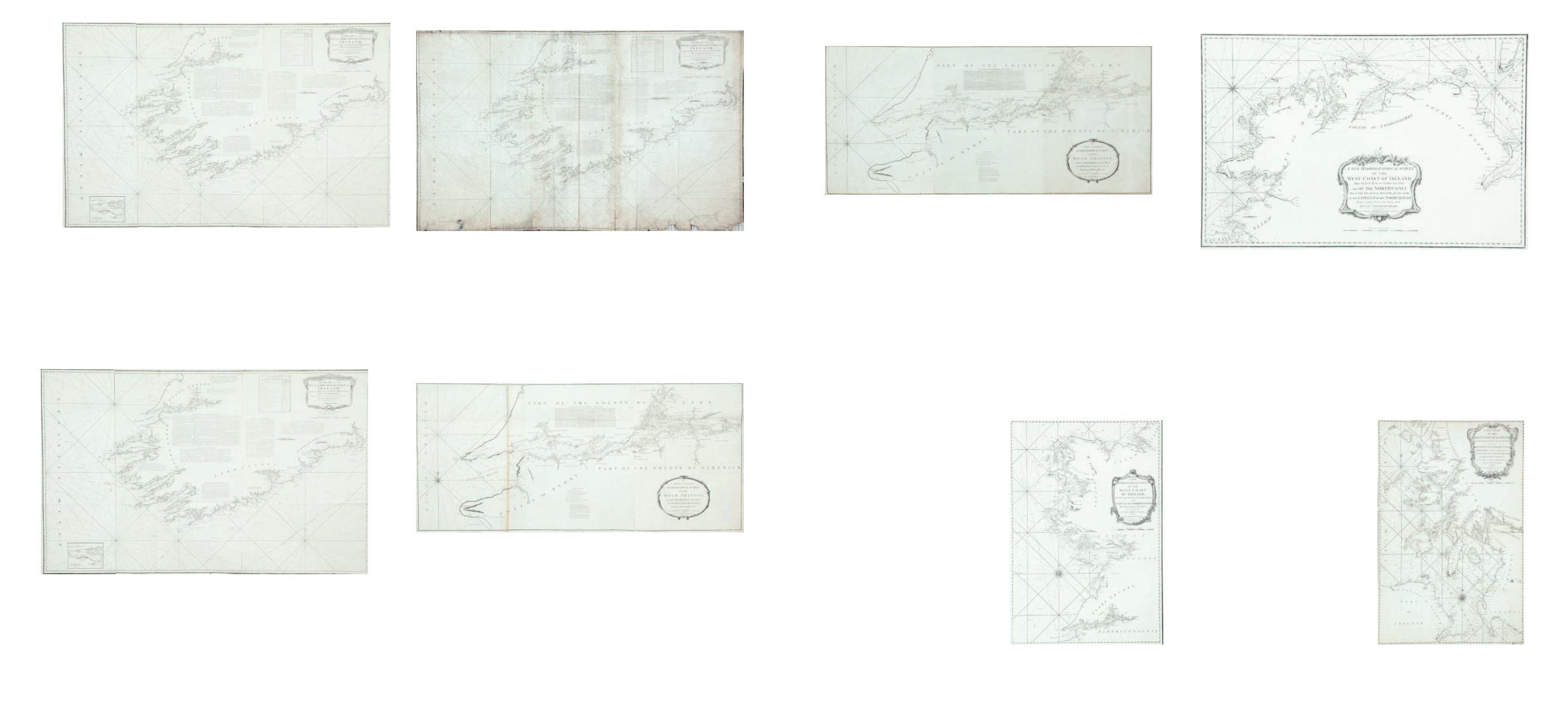
Huddart
Chart of the Shannon Estuary
The title is in an oval frame in the lower right corner and reads
“A New and Exact Hydro-
graphical Survey of the River Shannon; from Limerick to the Sea, with all the Banks, Shoals,
Rocks, Channels, Soun dings, Anchoring Places, &c.” Within the frame also is a “Scale of Two
Leagues or Six Miles 6 [= 142 mm.]” and the imprint “London. Printed for Robt. Sayer and
John Bennett, Fleet Street, as the Act directs 14 April 1781”.
Sayer and J. Bennett, No. 53 Fleet Street, as the Act directs 14 April 1781”.
1,560 x 725 mm.
€ 300 - 400
163
Huddart
Chart of the South-West Coast of Ireland
The title is in a classical rectangular frame in the top right corner and reads
“A Chart of the
West and South-West Coast of Ireland from the Mouth of the River Shannon to Waterford
Haven on the same Scale as the Chart of St. George’s C hannel. By Capt. Jos. Huddart. Lon-
don. Printed for R. Sayer and I. Bennett, Fleet Street, As the Act directs, August 1st 1780”.
1.270 x 785 mm.
€ 300 - 500