


 78-79 / 160

79
171
Sheet I,
Dublin to Carlingford
Surveyed by Commr Frazer 1839. Published in 1843 with
small corrections to 1865. Chart No. 1468.
615 x 462.
€ 100 - 150
172
Sheet II,
L. Carlingford to L. Larne
Surveyed by R. Hoskyn Master R.N., 1857-61. Corrections to
1872. Chart No. 45.
610 x 680.
€ 100 - 150
173
Sheet III,
Larne to Bloody Foreland
Surveyed by Capt. G.A. Bedford and R. Roskyn Master R.N.,
1883-59. Corrections to 1872. Chart No. 46.
980 x 620.
€ 150 - 250
174
Sheet IV,
Horn Head to Rathlin O’Byrne
Surveyed by Capt. G.A. Bedford, 1854, with small correc-
tions to August 1872. Chart No. 1245.
610 x 470.
€ 100 - 150
175
Sheet V,
Teelin Head to Downpatrick Head
Surveyed by Commr G.A. Bedford etc. Published 1858 with
corrections to July 1872.
480 x 640. Chart No. 2440.
€ 100 - 150
176
Sheet VI,
Downpatrick Head to Achill Head
Surveyed by Commr R.B. Beechey. Published 1855 with
corrections to August 1872. Chart No. 2419. 480 x 640.
€ 100 - 150
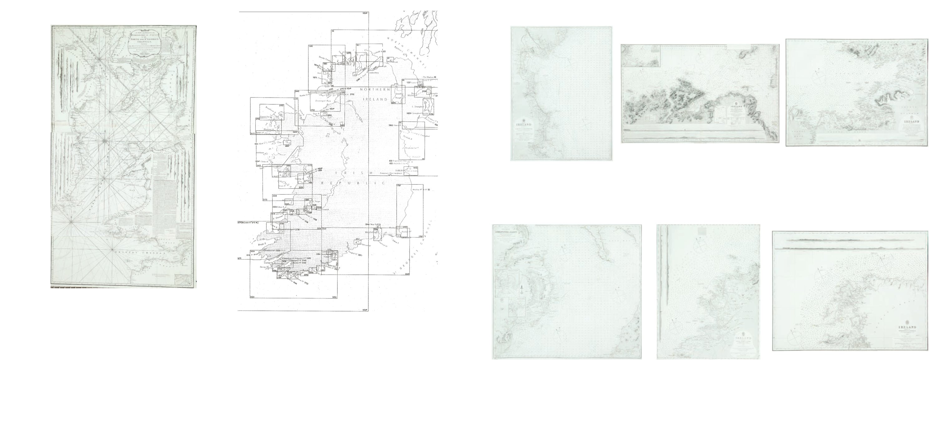
170
Huddart
Chart of the East Coast of Ireland and the Irish Sea
The title is in a scalloped frame with a cannon, flags, nets and an anchor, and reads
“A New and Original Hydrographical Survey of the North and St. George’s Channel Extending from Arran to Caldy Island on
the British Coast and from Skerries Port Rush to Bannow on the Irish Coast By Capt. Joseph Huddart London Published 12th May 1794 by Laurie & Whittle No. 53 Fleet Street.”
This is a reduced version of Huddart’s chart of the area which was first published in 1779 by Sayer and Bennett. This version was published in 1794 by Laurie and Whittle on two sheets and was included in
their Irish Coasting Pilot (1795). It was enlarged southwards by a small third sheet, to measure 1200 x 665 mm., and this form is the first chart in The North-about Navigator, published by Laurie and Whittle
in 1818.
It shows the whole Irish coast from Baginbun Head, county Wexford, to Portrush, county Antrim, and the British coast from Caldy Island in Pembrokeshire, to the Mull of Kintyre in Scotland, with detailed
soundings round the coast and across the Irish Sea. In the lower right there is a
“Scale of Nautic Leagues 20 to a Degree 10 [= 120 mm.]”.
There are also, as in the larger-scale version of the chart,
“A Table of
the Stream of Tide for every 1/2 Hour”
in the bottom centre,
“A Table of Time to be added to the end of the Stream”
in the bottom right corner, an
“Explanation”
of symbols in the centre, and a long passage
of “Remarks on the Chart of St. George’s Channel .... Royal Admiral, Mother Bank, 31 March 1778, Joseph Huddart.” There are scales of latitude along each side and of longitude, east and west from Dublin,
along the upper and lower borders. There are two compass roses showing north to the top, and many coastal profiles on all sides.
In the top right corner is an inset (120 x 110 mm.) entitled
“The Harbour of Lamblash in the Isle of Arran”, with a scale of “One Mile 3 [= 26 mm.]”.
665 x 980 mm.
€ 300 - 400
ADMIRALTY CHARTS
ADMIRALTY CHARTS KEY