


 84-85 / 160

85
www.adams.ieThe R.S.J.Clarke Collection of Cartography
15
th
December 2015
210
Abraham Ortelius (1527 – 1598)
Hiberniae Britannicae
A Map of Ireland from the 1573 Latin edition of Theatrum Orbis Terrarum. Black and
white. Abl P31.
€ 800 - 1,200
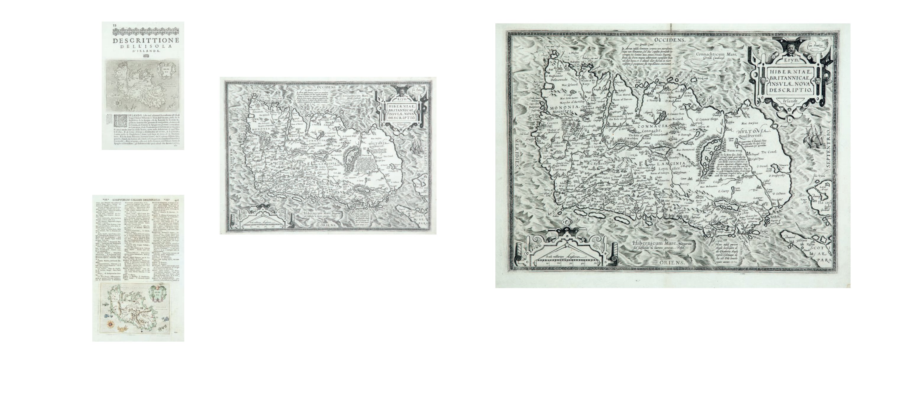
209
Abraham Ortelius (1527 – 1598)
Hiberniae Britannicae
A Map of Ireland from the 1573 Latin edition of Theatrum Orbis Terrarum. Black and
white. Abl P29.
Abraham Ortelius 1527 – 1598
Ortelius was born in the city of Antwerp, which was then in the Habsburg ruled, Seventeen
Provinces. The Orthellius family were originally from Augsburg, a Free imperial city of the
Holy Roman Empire. In 1535, the family had fallen under suspicion of Protestantism. Fol-
lowing the death of Ortelius’ father, his uncle Jacobus van Meteren returned from religious
exile in England to take care of Ortelius. Abraham remained close to his cousin Emanuel
van Meteren who would later move to London. In 1575 he was appointed
geographer to the King of Spain, Philip II, on the recommendation of Arias Montanus,
who vouched for his orthodoxy. He is conventionally recognized as the creator of the first
modern atlas, the Theatrum Orbis Terrarum (Theatre of the World), and is also believed to
be the first person to imagine that the continents were joined together, before drifting to
their present positions.
€ 800 - 1,200
207
Thomaso Porcacchi (1530–1585)
Irlanda
From his L’Isole Pio Famose de Mondo (1572) published in Venice in 1572. 150 x 110. Abl
P26.
€ 0 - 0
208
Thomaso Porcacchi and Girolamo Parro
Irlanda
From their Labor a Vorea’s Universus Ferarum Orbis (C.1713). 150 x 110. Abl P27.
€ 70 - 120