


 40-41 / 160

41
80
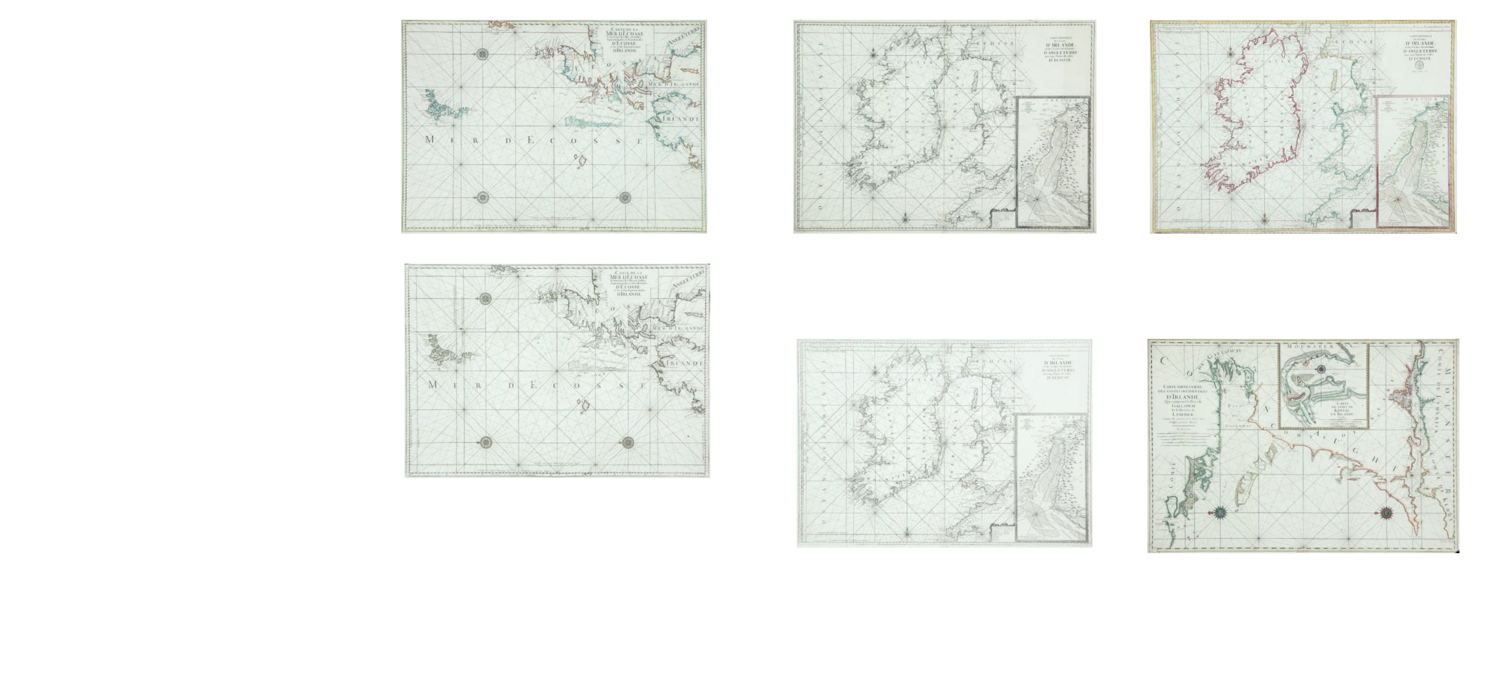
Charles Pene
A Chart of Northern Ireland and Scotland (1753)
“Carte de la Mer d`Ecosse Contenant les Isles et Costes Septentrionales et Occidentales
d`Ecosse et les Costes Septentrionales d`Irlande.”
From Bellin`s Le Neptune Francois. No watermark but addition of various scales (1753).
870 x 605.
€ 250 - 350
82
Charles Pene
A Chart of Ireland and the West Coast of England (1753)
“Carte Generale des Costes d`Irlande et des Costes Occidentales d`Angleterre avec une
Partie de celles d`Ecosse.”
As 1753 chart but with Depot de la Marine mark and “No 11” in top right corner. (1772).
865 x 605.
€ 250 - 300
83
Charles Pene
A Chart of Galway Bay and the Shannon with Kinsale Insert
(1695)
“Carte Particuliere des Costes Occidentales d`Irlande Qui comprend la Baye de Galloway et
la Riviere de Lymerick. Comme elles paroissent a basse mer dans les grands Marees.”
Watermark “BYCOLOMBIER” (1693). 870 x 605.
€ 250 - 300
81
Charles Pene
A Chart of Ireland and the West Coast of England (1753)
“Carte Generale des Costes d`Irlande et des Costes Occidentales d`Angleterre avec une
Partie de celles d`Ecosse.”
From Bellin`s Le Neptune Francois. No watermark but addition of various scales (1753).
865 x 605.
€ 250 - 300
Charles Pene, surveyor and cartographer, was editor of the great volume of
charts called Le Neptune Francois, which was published in Paris in 1693 (Bellin, 1753; Koe-
man, 1970; Pastoureau, 1984). He had been granted leave to publish the atlas by Louis XIV
on 27th December 1691 as a private publication, though presumably with royal support.
The other authors were Sauveur and de Chazelles, and the ingenieures or surveyors who
had been involved in surveys of France since 1666, were de la Voye, Duchon, Sabran,
Razaut, de la Favoliere, Minet and de la Gennes. Engravers included H. van Loon and C.
Berey, who signed the second and third of the Irish charts. There is a scale of latitude in
all cases, and a single scale of longitude relative to l’Isle de Fer, though this is not stated.
It was the most westerly point of Europe / Africa and the traditional point used in Europe
since the time of Ptolemy. The sheets of the Pene edition all have the watermark of “BY-
COLOMBIER” and the two-headed swan.
At this time the Dutch were the leading publishers of sea charts and they de-
cided to reproduce or pirate the atlas in their own form, in the same year. Pierre Mortier
of Amsterdam in partnership with Hubert Jaillot of Paris had all the plates re-engraved,
but omitting the original engravers’ names and adding phrases to some titles such as
“Levees et Gravees Par Ordre du Roy, Paris”. There was also the date “1693” on some. The
lettering was also slightly different and the compass roses less ornate.
By 1751 the French Depot des Cartes et Plans de la Marine decided that a new
edition of Le Neptune Francois was required. Although the original plates had become
dispersed, as many as possible were collected and two missing plates (one being that
of the Galway-Shannon chart), were replaced by new ones. Multiple scales of longitude
were now added, relative not only to l’Isle de Fer as before, but to Paris (the observatory),
Tenerife, Cap Lezard and Londres (St. Paul’s cathedral). The new edition was published in
Paris in 1753 under a new editor, Jacques Nicolas Bellin, who describes the history of the
atlas in the preface, and makes it clear that the charts are unchanged in detail from those
of 1693.
The next recognisable change was that in 1773 the mark of the “Depot de la
Marine” and a price were added. This at first read “Prix trente Sols” but after the Revo-
lution (1789) rose to “Prix cinquante Sols”. At this latter stage also the fleur-de-lis in the
compass rose was replaced by the cap of liberty or an arrow, and those of the Depot mark
omitted or replaced by “R.F.” A copy of the Galway-Shannon chart has also been seen with
the fleur-de-lis on compass rose and Depot mark scored out in ink, presumably during the
Revolution. However, the atlases of the period are mixed in their chart-types.
Bellin also introduced into his Neptune Francois a series of “Cartes Reduites
des Isles Brittanique” dated 1757. They appear to have been used alternatively with the
Pene series and are described under his name.
78
Charles Pene
A Chart of Northern Ireland and Scotland (1693)
“Carte de la Mer d`Ecosse Contenant les Isles et Costes Septentrionales et Occidentales
d`Ecosse et les Costes Septentrionales d`Irlande.”
Watermark “BYCOLOMBIER” (1693). 870 x 605.
Surveyor and cartographer, original editor of the great volume of charts called Le Neptune
Francois, published in 1693. Three charts of the Irish coast, originally from Le Neptune
Francois but in various editions and states.
€ 250 - 400
79
Charles Pene
A Chart of Northern Ireland and Scotland (1753)
“Carte de la Mer d`Ecosse Contenant les Isles et Costes Septentrionales et Occidentales
d`Ecosse et les Costes Septentrionales d`Irlande.”
From Bellin`s Le Neptune Francois. No watermark but addition of various scales (1753).
870 x 605.
€ 150 - 250
Pene, Charles (fl.1679)
78
79