


 16-17 / 160

17
16
Theunis Jacobsz (1606-1650)
A Chart from Dublin to South of Wexford. Corkbeg (1689)
“De Zuyd Oost zyde van Yerlandt Van Dubling tot aen
t`Eylandt Corkbeg.
” A later state of the plate, from the 1689
Zee-Spiegel with the addition of a bar showing latitude.
Verso blank. 530 x 410.
€ 250 - 350
18
Theunis Jacobsz (1606-1650)
A Chart of the North-west Coast of Ireland (1689)
“De Noordwest zyde van Yerlandt Beginninde van Capo de
Hoorn tot aen Schynrs, ofte Slyne-head.
” A later state of the
plate, from the 1689 Zee-Spiegel with the addition of a bar
showing latitude. Verso blank. 530 x 410.
€ 250 - 350
19
Theunis Jacobsz (1606-1650)
A Chart of Ireland and the Irish Sea (1666)
“Pascaerte om achter Yrlandt om to zeylen van Hitland tot
aen Heysant; Nieuw lycx uytgegeven `t Amsterdam by
Theunis Jacobsz op t`water inde Lootsman.” From the
Nieuwe Water-Werelt Ofte Zee-Atlas of 1666 of Jacob
“Lootsman”. Verso blank. 540 x 440.
€ 250 - 350
17
Theunis Jacobsz (1606-1650)
A Chart of the North-east Coast of Ireland (1689)
“De Noord-oost zyde van Yerlandt van Caap de Hoorn tot
aen Hedehde en als mede hoe t`van Schotlandt gelegen is.”
A later state of the plate, from the 1689 Zee-Spiegel with
the addition of a bar showing latitude. Verso blank. 530 x410.
€ 250 - 350
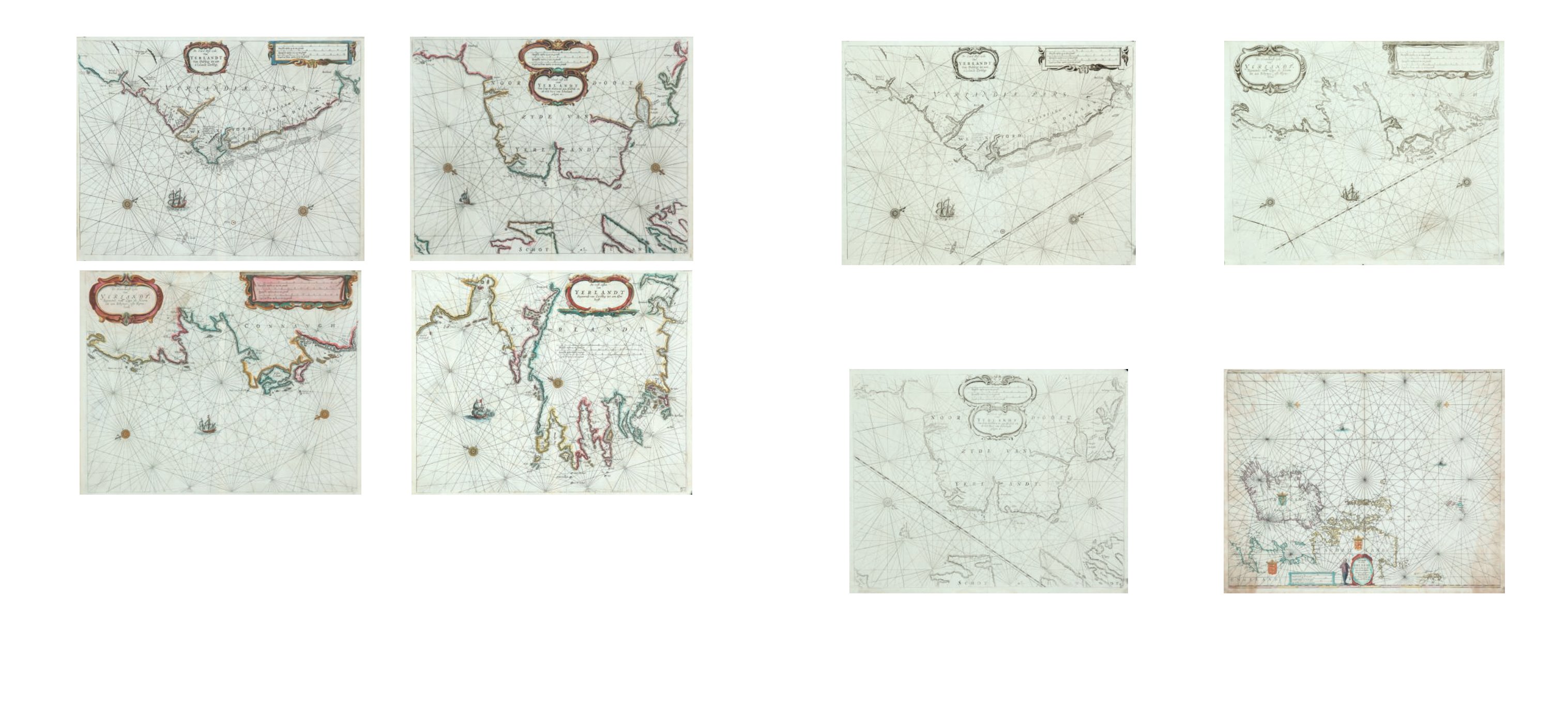
15
Theunis, Jacobsz.(1606-1650)
Set of Four Charts of the Irish Coast including South-east,
North-east, North-west and South-west
(i) “De Zuyd Oost zyde van Yerlandt Van Dubling tot aett`Eylandt Corkbeg.”; (ii) “De Noord-oost zyde van Yerlandt
van Caap de Hoorn tot aen Hedehde en als mede hoe t`vanSchotlandt gelegen is.”; (iii) “De Noordwest zyde van
Yerlandt Beginninde van Capo de Hoorn tot aen Schynrs, ofte Slyne-head.”; (iv) “De west custen van Yerlandt
Beginninde van Corckbeg tot aen Slyne-hooft.”
A Set of four charts of the Irish coast from the 1643 edition of De Lichtende Columne ofte Zee-Spiegel, English edition. They
have numbers 41-44 in the lower right corner and verso blank. 530 x 410.
€ 1,500 - 2,000