


 12-13 / 160

13
9
Hendrick Doncker (1625-1699)
A Chart of the British Isles (1670)
“Pascaart van `t Canaal Vertoonende in `t Geheel Engelandt,
Schotlandt, Yrlandt en een gedeelte van Vranckryck,
Nieulycks uytgegeven t`Amsterdam by Hendrick Doncker,
Boeckverkooper en Grand-boogh macker” from the Zee- Atlas Ofte Water-Waereld, of c
1670. Verso blank. 540 x430.
€ 250 - 350
8
Hendrick Doncker (1625-1699)
A Chart of the West Coast of Scotland and the North-northeast Coast
of Ireland (1703)
“Pascaert van de West cust van Schotland van de Inwyck van Lougreau tot `t Eyland Skye
`t Amsterdam By Hendrick Doncker.”
This chart was added to the Nieuw Groot
Steurmans Zee-Spiegel for the 1681 edition and this state with a meridian bar graduated
for latitude dates from 1703. No 41 in lower right corner. Verso blank. 530 x 430.
€ 250 - 350
7
Hendrick Doncker (1625-1699)
A Chart of the South-east Coast of Ireland (1664)
“Yrlandt van Dubling tot Corkbeg” and “Le Coste de Zudest
d`Irlande, de Dubling jusques a Corcbeg”
in separate cartouches. This is from the first edition of the Nieuw Groot
Steuermans Zee-Spiegel (1664). No 42 in lower right corner. Verso blank. 530 x 420.
€ 250 - 350
6
Hendrick Doncker (1625-1699)
A Chart of Ireland and the Irish Sea (1663)
“Paskaarte om Achter Yrlant om te Zeylen, van Hitland tot aen Heyssant, Nieulycx uytge-
geven t`Amsterdam by Hendrick Doncker, inde Nieuwenbrugh steech In`t
Stuurmans Gereetschap.”
.
This chart first appeared in his Zee-Atlas ofte Water-Waereld in 1659 and this is the second
state from an edition of 1663. Verso blank. 530 x 430.
€ 250 - 350
contain a chart of Ireland, but the older atlas continued to be published until 1678.
The Nieuwe Groot Stuermans Zee-Spiegel was first published in 1664 and ran
to 11 editions under various names, until 1704. There was also an English edition (1670,
title only known) and a French (1689).
The above two atlases were independent publications, but an edition of the
collaborative Lichtende Columne ofte Zee-Spiegel, between Goos, Jacobsz and Doncker,
though attributed to the last, was published in 1655. It contains the four regional Irish
charts made from plates first prepared by Jacobsz in 1646 and sold to Pieter Goos for
his 1650 edition of the Zee-Spiegel. The Doncker volume is simply Peter Goos’s 1650
Zee-Spiegel, with a slip pasted on the title page. The four Irish charts are listed under
Jacobsz.
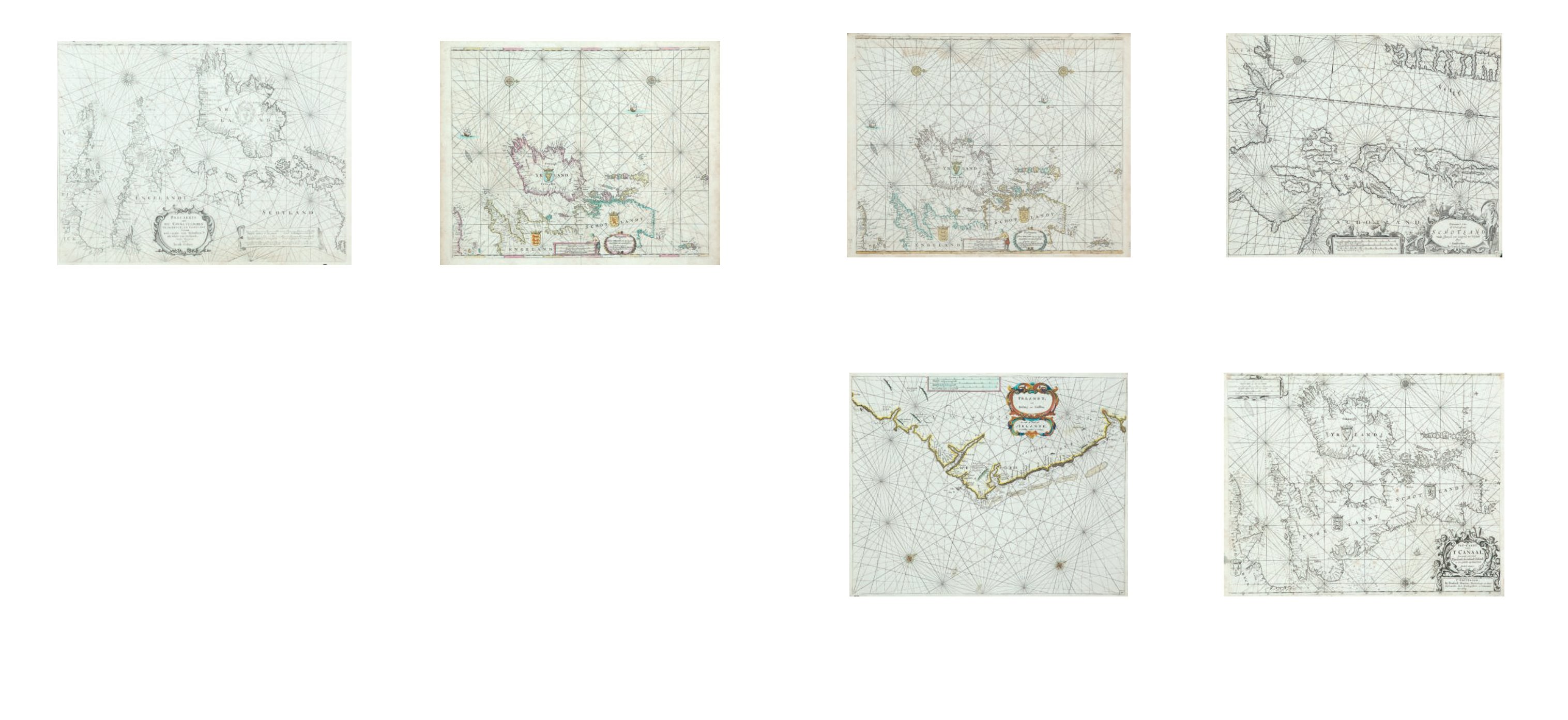
5
Doncker, Hendrick (1625-1699)
A Chart of Ireland and the Irish Sea (1663)
“Paskaarte om Achter Yrlant om te Zeylen, van Hitland tot
aen Heyssant, Nieulycx uytgegeven t`Amsterdam by
Hendrick Doncker, inde Nieuwenbrugh steech In`t
Stuurmans Gereetschap.”
This chart first appeared in his Zee-Atlas ofte Water-Waereld in 1659 and this is the second
state from an edition of 1663. Verso blank. 530 x 430.
€ 250 - 350
4
Jacob Aertsz Colom (1600-1673)
A Chart of the British Isles
“Pascaerte van Het Canael Tusschen Vranckryck en
Engelant Van de west-zyde van Schotlant als Mede van
Ierlandt Nieulix Wtgegeven Door Iacob Colom”,
essentially a chart of the British Isles, from the Atlas of Werelts-Water
(1663). Verso blank. 560 x 420.
€ 150 - 250
Hendrick Doncker was born in 1625/6, probably in Amsterdam, and was a
member of the booksellers’ guild by 1647. He married firstly, in 1648, Elizabeth Abraha-
msd. van Rensing of Amsterdam and lived in a house in the Nieuwe Brugsteeg. They had
a son Hendrick II who was born c. 1664. Elizbeth died in 1675 and Hendrick remarried a
year later the 40-year old widow of the Minister Lupenius, who eventually outlived him by
a few years. Hendrick I died in 1699, and his son Hendrick II continued the business. He,
however, produced no new chart-books, and died in 1739.
The first publication by Hendrick Doncker I was De Zee-Atlas ofte Water-Waer-
eld which first appeared in Dutch in Amsterdam in 1659 and stayed in print until 1705.
There were approximately 21 Dutch editions by this time, as well as 3 in French (1667,
1679 and 1689), 3 in English (1660, 1676/7 and 1678) and 1 in Spanish (1669). It contains
one chart covering Ireland, much of the north Atlantic Ocean and the western half of
Britain from the Shetland Isles southwards. It is derived from Colom’s chart I (1632) and
became a patern for similar charts by van Loon (1661), Goos (1666), Jacobsz (1666) and
Robijn (1683). The atlas was enlarged in the number of charts and the page size in 1675,
under the title of De Nieuwe Groote Vermeerderde Zee-Atlas, only some editions of which
Doncker, Hendrick (1625-1699)