


 114-115 / 160

115
www.adams.ieThe R.S.J.Clarke Collection of Cartography
15
th
December 2015
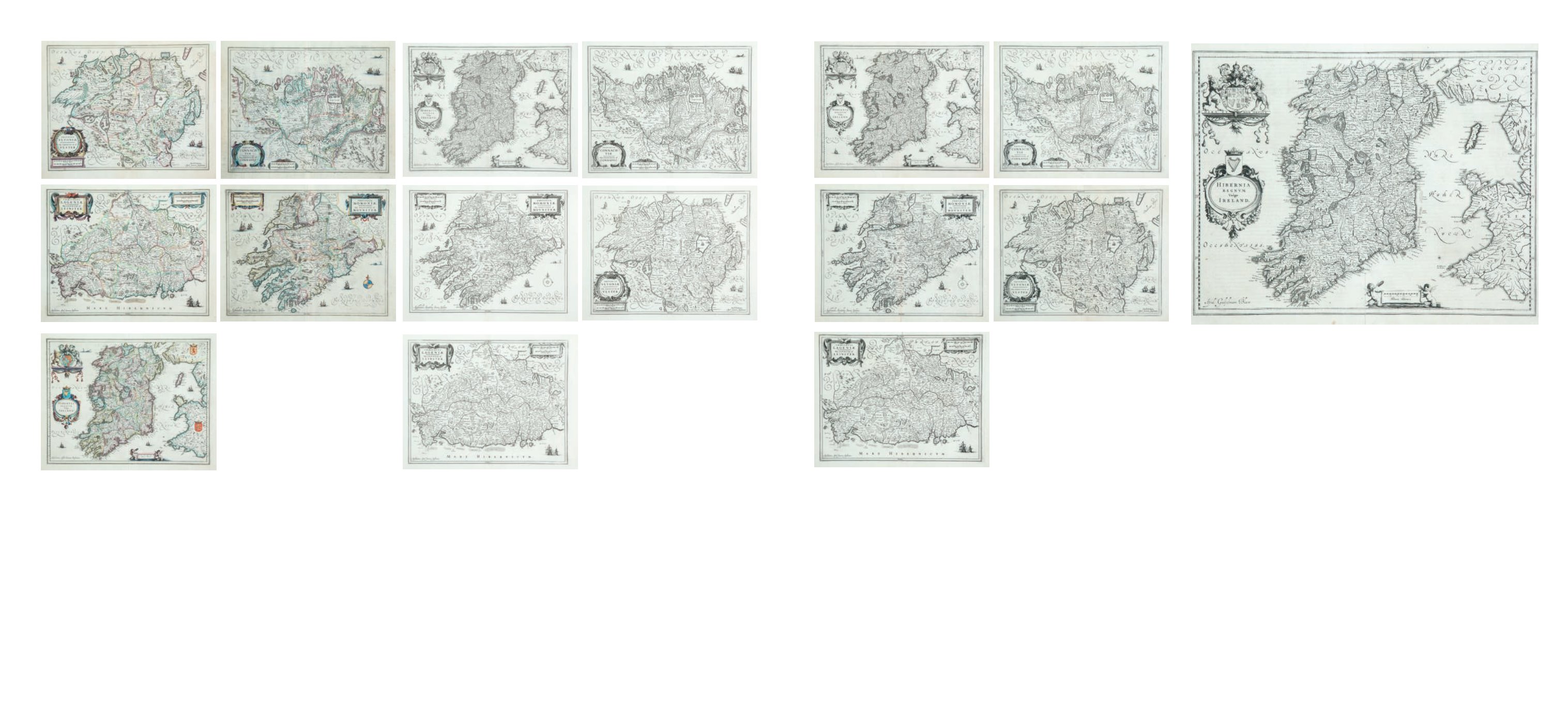
295
Johannes Jansson (1588-1664)
A Set of Five Maps,
Ireland, Munster, Leinster, Connaught, Ulster, from Vol I of the German edition of his Atlas
Novus, 1636. Abl ME44. (5)
€ 1,500 - 2000
296
Joan Blaeu (1596-1673)
A Map of Ireland
“Hibernia Regnum”. Taken from the Theatrum Orbis Terrarum. Published in 1635.
Latin text verso. 380 x 500.
Joan Blaeu 1596 – 1673
Blaeu was a Dutch cartographer, born in Alkmaar, the son of cartographer Willem
Blaeu. In 1620 he became a doctor of law but he later joined up with his father. In
1635 they published the Atlas Novus (full title: Theatrum orbis terrarum, sive, Atlas
novus) in two volumes. Joan and his brother Cornelius took over the studio after
their father died in 1638. Joan became the official cartographer of the Dutch East
India Company. Blaeu’s world map, Nova et Accuratissima Terrarum Orbis Tabula,
incorporating the discoveries of Abel Tasman, was published in 1648. This map
was revolutionary in that it “depicts the solar system, according to the heliocentric
theories of Nicolaus
Copernicus, which show the earth revolving around the sun. Although
Copernicus’s groundbreaking book ‘On the Revolutions of the Spheres’ had been first
printed in 1543, just over a century earlier, Blaeu was the first mapmaker to incorpo-
rate this revolutionary heliocentric theory into a map of the world.
€ 400-500
293
Johannes Jansson (1588-1664)
A Set of Five Maps,
Ireland, Munster, Leinster, Connaught, Ulster, from Vol IV of the German edition of his
Atlas Novus, 1638. Abl ME120. (5)
€ 3000 - 4,000
294
Johannes Jansson (1588-1664)
A Set of Five Maps,
Ireland, Munster, Leinster, Connaught, Ulster, from Vol VI of the Latin edition of his Atlas
Mayor. Abl ME154. (5)
€ 1500 - 2000