


 106-107 / 160

107
www.adams.ie266
Petrus Bertius (1565 –1629)
A Set of Seven Maps
Ireland, Northern Ireland, Southern Ireland, Connaught, Media, Lenister, Udrone
(1616). Latin Text. Abl P210. (1-7) 134 x 94
Petrius Bertius 1565 - 1629
He was born in Beveren (Alveringem), the son of a Flemish preacher Pieter Michielszoon Bardt, who left Flanders for religious exile in London around 1568, with his family.
In 1577 Petrus Bertius returned to the Netherlands, to study at the University of Leiden. He supported himself by tutoring younger students and continued travelling in
Europe. In 1593 he was appointed to subregent of the Leiden Statencollege, marrying in the same year Maritgen, daughter of Johannes Kuchlinus, the first regent of the
Statencollege, whom he would succeed after his death in 1606, as a regent. He was also connected by marriage to Jodocus Hondius and Pieter van den Keere, his broth-
ers-in-law and both cartographers, and this would influence his later life. He became in 1620 a convert to the Roman Catholic Church, and also whereupon professor of
rhetoric at the Collège de Boncourt, a part of the University of Paris. In 1622, Louis XIII set up a new personal chair in mathematical sciences in the royal college for Bertius,
and granted him the title of royal historian. He died in Paris.
€ 500 - 700
268
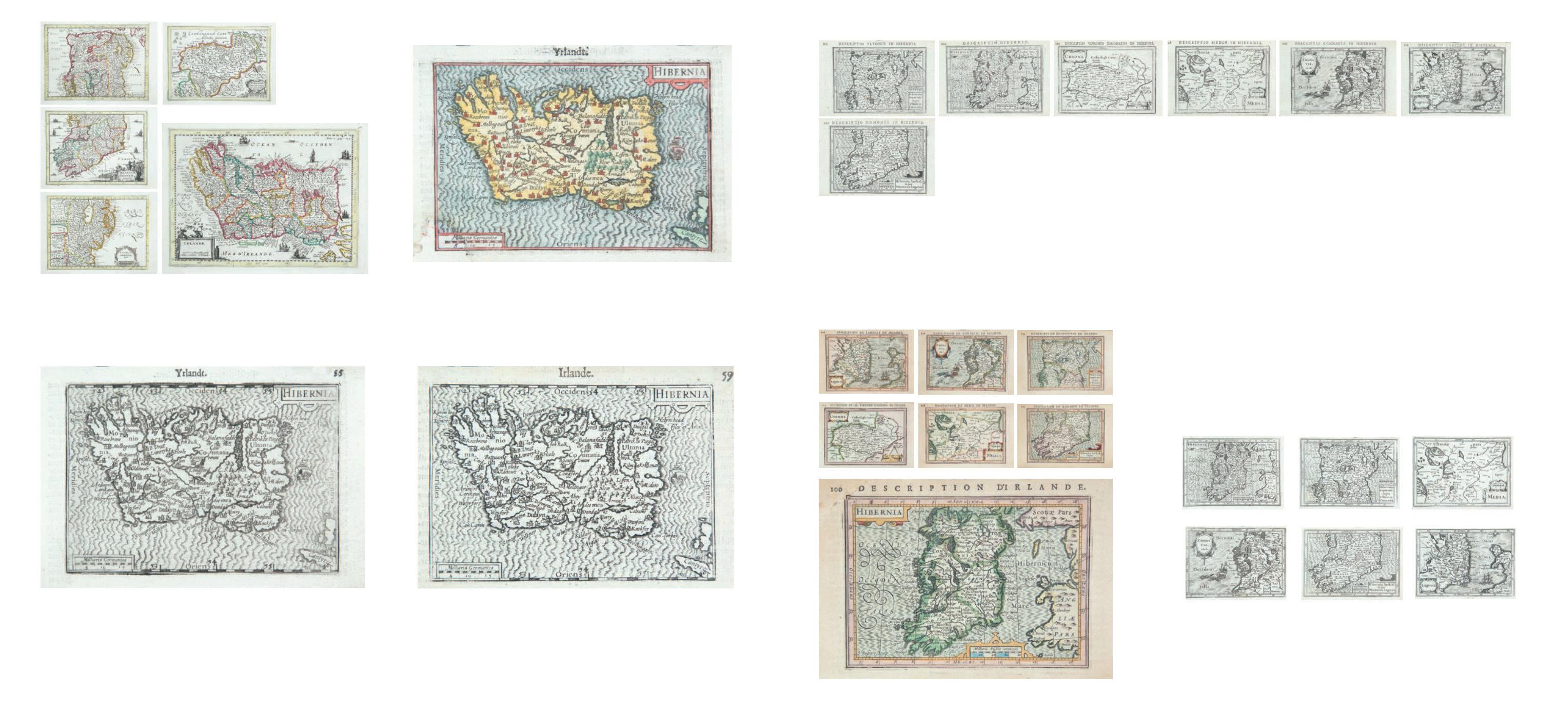
Petrus Bertius (1565 –1629)
A Set of Six Maps
Ireland, Connaught, Northern Ireland, Southern Ireland, Media, Leinster
Published by Blaeu in his Epitome of Camden’s Britannia. (1639). Without Text on Verso.
Abl P213(i-vi). (1-7) 134 x 94
€ 300- 400
267
Petrus Bertius (1565 –1629)
A Set of Seven Maps
Ireland, Northern Ireland, Southern Ireland, Connaught, Media, Lenister, Udrone
Col. 1618. French Text. Abl P211. (1-7) 134 x 94
€ 400 - 600
263
Gerard Mercator (1512-1594)
A Set of Five Maps of Ireland
from Henri de Sauzet’s Atlas Portatif using the large Cloppenburg Plates with additions to
some maps. (1734). Dutch edition, coloured, verso blank. 260 x 185. Abl 180. (1-5)
€ 400 - 600
265
Barent Langenes / Petrus Bertius
Ireland
Plate 1. State 2. Publisher Cornelius Claez. (1599). Dutch text. 12 x 85cm. Abl P201.
€ 60 - 100
265A Barent Langenes / Petrius Bertius
Ireland
Plate 1. State 2. Publisher A. Henry C. Nicolas. (1600). French text. 125 x 85cm. Abl P202.
€ 60 - 100
264
Barent Langenes / Petrus Bertius
Ireland
Plate I. State I. Publisher B. Langenes. (1598). Dutch text. Abl P200.
€ 60 - 100
NB. All maps are the same size.