


 104-105 / 160

105
The R.S.J.Clarke Collection of Cartography
15
th
December 2015
260
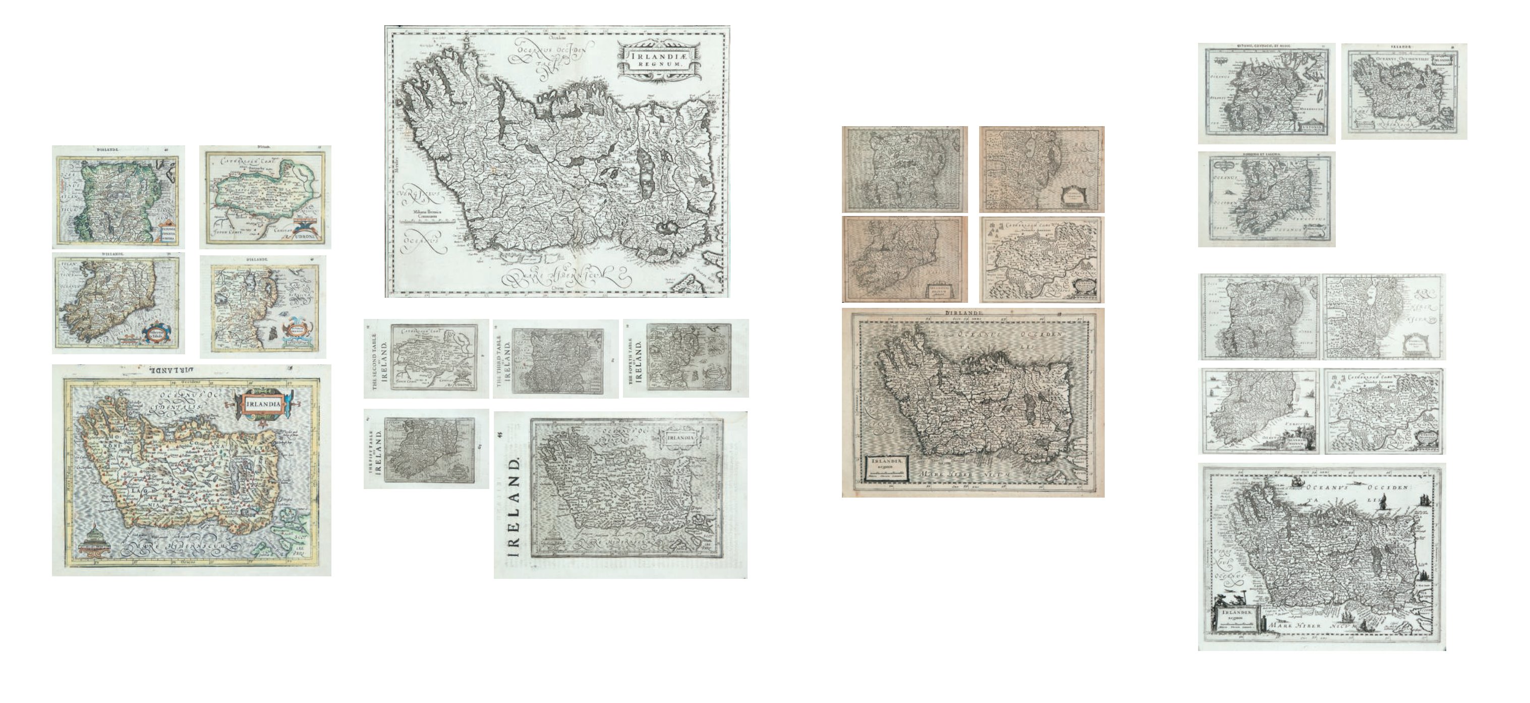
Gerard Mercator (1512-1594)
A Set of Three Maps
(all issued) from Mercator’s Atlas Minor
using the Jasson plates. (Irlandia, Ultonia, Momonia). (1630) French text on verso. Abl
P170.
€ 200 -400
262
Gerard Mercator (1512-1594)
A Set of Five Maps of Ireland
from Henri de Sauzet’s Atlas Portatif using the Cloppenburg Plates with additions to some
maps. (1734). Dutch edition. Verso blank. 260 x 185. Abl 180. (1-5)
€ 400 - 600
261
Gerard Mercator (1512-1594)
The Complete Irish Section
(five maps and six pages of text)
From Mercator’s Atlas Minor with Cloppenburg Plates. (1630). French text on verso. Abl
176. (1-5)
€ 400 - 600
257
Gerard Mercator / Hondius / Jansson
Irlandia Regnum
No text verso. Second state. c.1650.
C470 x 340
259 Gerard Mercator (1512-1594)
A Set a Five Maps
From the English Edition of Mercator’s Atlas Minor. This edition 1635. English text on verso
(1635). Abl P166 (1-5).C185 x 133
€ 300 - 400
258
Gerard Mercator (1512-1594)
A Set of Five Maps
From Mercator’s Atlas Minor Hondius. Plates Udrone, Southern Ireland, Ultonia, Northern
Ireland and Ireland (1608). French text on verso. Abl P163.
€ 300-400
257
259
258
260
262