


 165 / 244

165
The History Sale 2015
www.adams.ie615
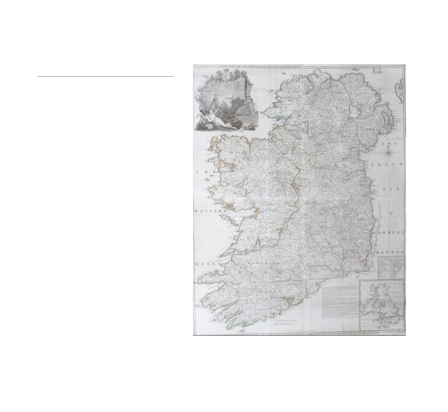
JOHN ROCQUE
A Map of the Kingdom of Ireland, Divided into/Provinces
Counties and Baronies, Shewing/The Archbishopricks,
Bishopricks, Cities, Boroughs, Market Towns,/Villages,
Barracks, Mountains, Lakes, Bogs, Rivers, Bridges,/Fer-
ries, Passes; Also the Great, the Branch, & the By Post /
Roads, together with the Inland Navigation &c by J:ROC-
QUE/Chorographer to ye Prince of Wales
Engraving, 1250 x 967mm
Appears in an elaborate cartouche towards the tl. It is
written on the crumbling stone wall flanked by pillars. Be-
low are a pair of cows and below them is a well-rounded
lady lacking her clothes lying on a bed of reeds. At the
br is an inset map of the British Isles. Above this is a box
containing a key in Latin and English and to the left is
another box with details of the country. Just to the left of
centre are 2 lines of scale and below and to the right of
these, just inside the border, is the imprint ‘London Print-
ed for Robt Sayer opposite Fetter Lane Fleet Street.’
€1500 - €2000