


 160 / 244

160
info@adams.ie602
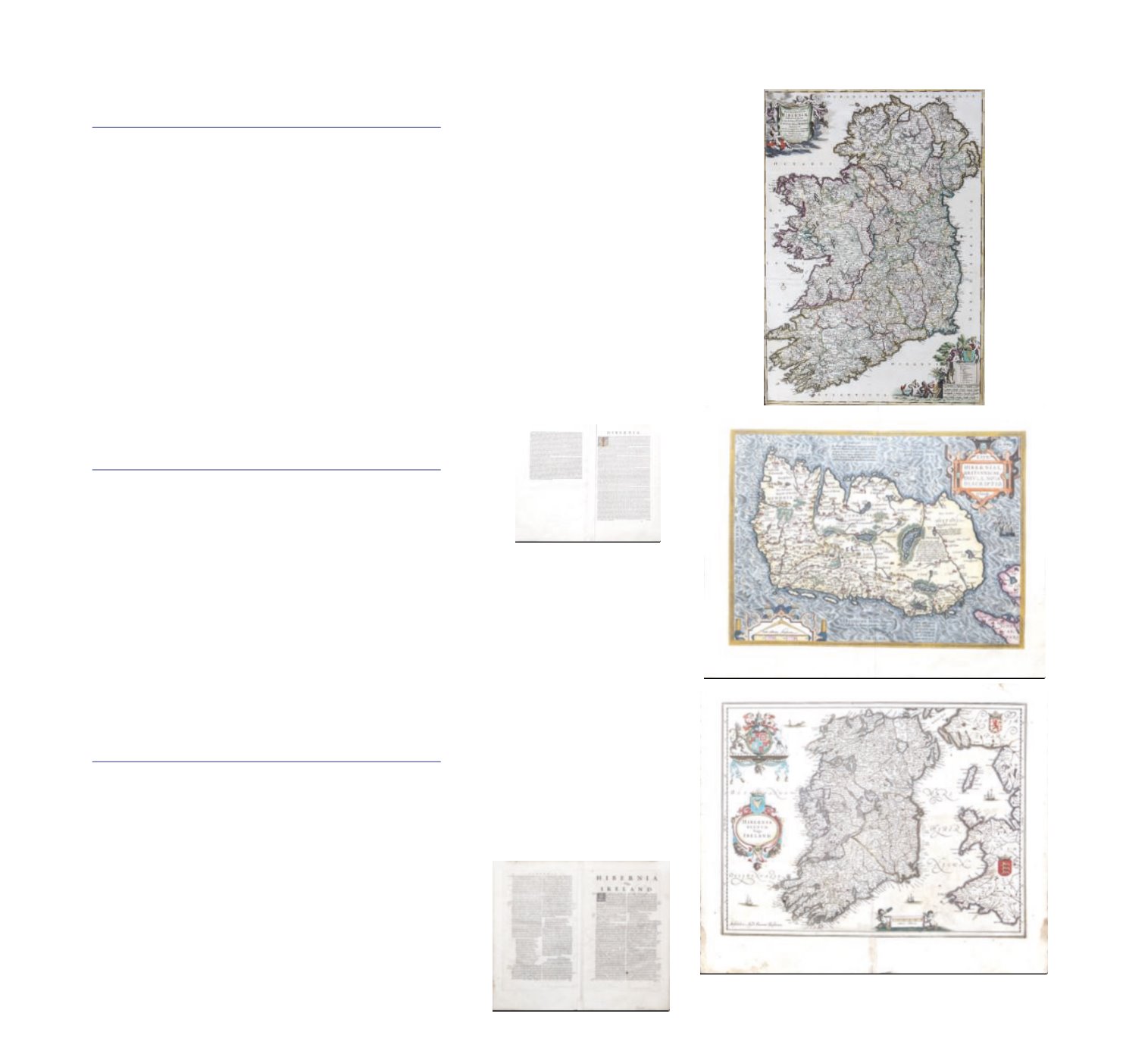
FREDERICK DE WIT 1629-1706
Novissima ac prae caeteris alus accuratissima / REGNI et INSULAE / HIBERNIAE /
Delineatio, in qua sunt / LAGENIA, ULTONIA, / CONNACHIA, et MOMONIA /
PROVINCIAE, / Divisae in triginta duos Comitatus / qui et sunt divisi in omnes
subjacentes / Baronnatus, per / FrederiCUM DE WITT / Amstelodami cum Privilegio
D.D.Ordinum / Hollandiae Westfrisiaeq.
A map of Ireland
original colour
496x713mm
Aabl DS 2(i)
€300 - €500
603
ABRAHAM ORTELIUS 1527-1598
Hibernia Eryn Hiberniae Britannicae insula nova descriptio- Irlandt
A map of Ireland showing the mull of kintyre. Hand coloured engraving. Taken from Ortelius
Theatrum Orbis Terrarum, first published in 1570. Ireland appears first in additamentum in 1573.
The plate engraved in 1572. Latin text verso Hand coloured engraving. 440 x 550cm sheet Abl
p.36
€1,000 - €1,500
604
JOANNES JANSSON
Magnae Birtanniæ et Hiberniæ nova descriptio A map of Ireland and the British Ilses Hand
coloured engraving. 490 x 590mm
€300 - €400