


 86 / 114

Wednesday 26th April
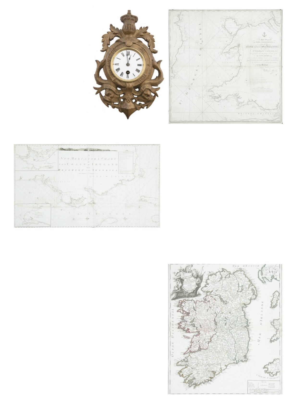
182 GEORGE LOUIS LE ROUGE (1712-1790)Le Royaume D’Irlande. From his Atlas Generale published in Paris in 1745-64. 485
x 570. Abl 78(i).
€ 150 - 250
181 MURDOCH MACKENZIE XXXII.Chart of the North East Coast of Ireland
This chart was printed in a left and right half, which are separate in the B.L. version but can be
mounted together. It has “Pl. 2” printed above the top right and left corners. It is one of the six
charts published after Murdoch Mackenzie`s death but based on his surveys (only acknowledged
in the second state).
The title in the top centre, unframed, reads “A New Mercator`s Chart of the Coast of Ireland
from Drogheda to the Skerries. The imprint below the frame reads “London, Published as the
Act Directs, Jany. 1st 1800, by D. & E. Steel at the NavigationWarehouse, LittleTower Hill.”
North is to the right and there are scales of latitude and longitude west from London along the
four borders, There is a key to “References” or symbols framed to the left of the title and one
coastal profile in the top centre. There are two insets:-
1. “A Chart of Strangford Loch”., with a “Scale of four English Miles 4” and showing north to
the bottom right.
2. “A Chart of Carlingford Loch and Dundalk Bay.”, with a “Scale of four English Miles 4”.
North is unmarked but at the bottom. 1,310 x 765mm.
€ 150 - 250
180 WILLIAM MORRISChart of St. George’s Channel
This is a loose chart, considerably modified from Lewis Morris’s chart of
1748 covering the same area, which was published in 1800.
It shows the Irish coast from Carnsore Point, countyWexford, to Lambay
Island, county Dublin, as well as the British coast from north Somerset
and Cardiff to Formby, Lancashire. The title in the centre right, unframed,
reads “To the Right Honourable the Lords Commissioners for executing the
Office of Lord High Admiral of Great Britain, Ireland, &c.This Chart of St.
George’s Channel &c. Surveyed under their Lordships’ direction by the late
Lewis Morris Esqr. which is now extended by an Actual Survey (the whole
Corrected & much Improved) from Liverpool to Cardiff in the Bristol
Channel; is by Permission most respectfully dedicated by their Lordships’
obedient humble servantWilliam Morris”. Below the lower margin is
“Published 25th Novr. 1800 byWillm. Morris. Engraved byWm. Simpkins,
Clements Inn”. Below this is an explanation of symbols and below it, un-
framed, is “A Scale of Leagues 10 [= 147 mm.]”.There is one compass rose
showing north to the top and there are scales of latitude and longitude (W.
from London) along all four borders. 780 x 885mm.
Provenance:The Richard S.J.Clarke Collection
€ 80 - 120
179 A NAVAL-THEMED WALL CLOCK,with 3in. enamel dial, with black steel hands and
winding arbor to continental pendulum move-
ment, contained within a cast-brass decorative
mount, with Royal motto, dolphins and anchor
-- 12½in. (32cm.) high
€ 200 - 300