


 18 / 114

18
Wednesday 26th April
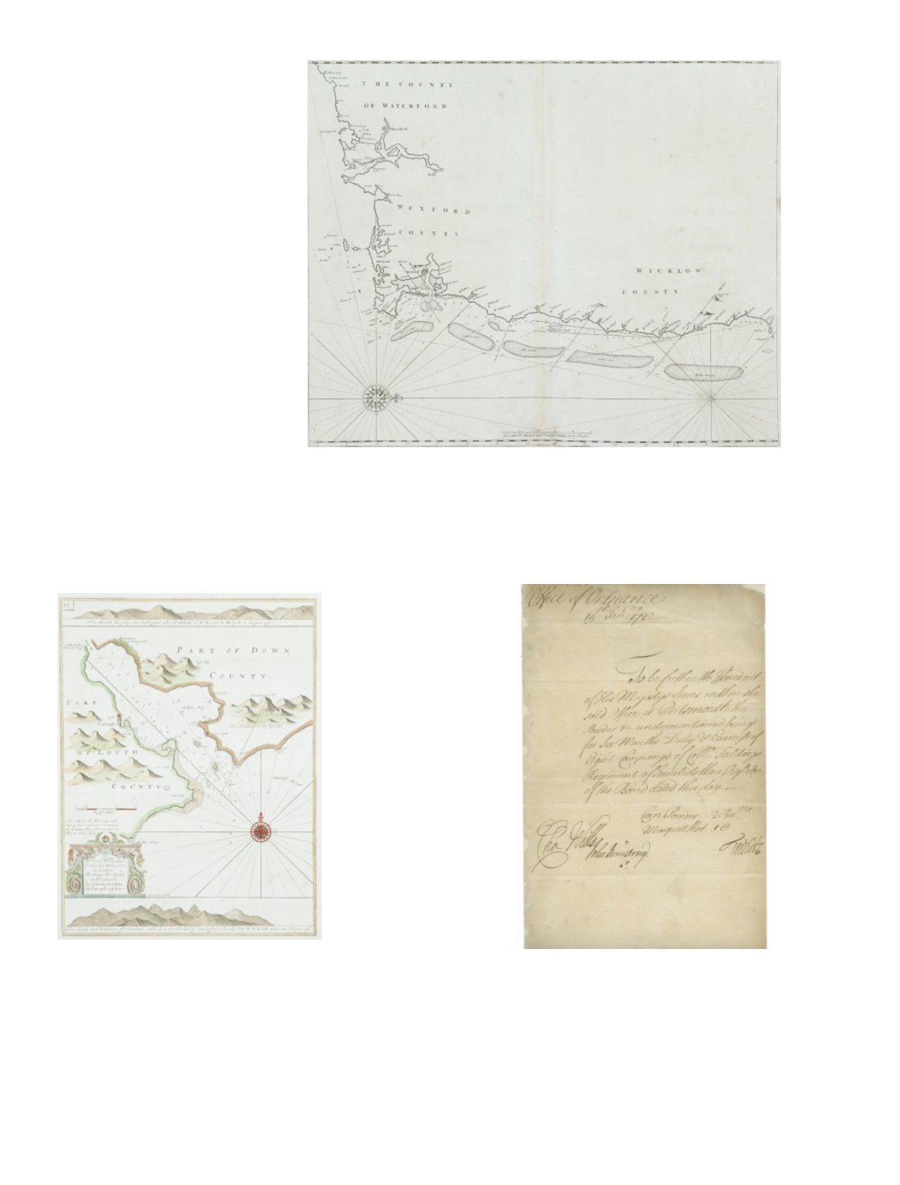
21 JOHN SELLER (1634-1697)Chart of the South-East Coast of Ireland
This chart appears first in Seller’sThe English Pilot, Southern Navigation of 1690, and it was unchanged in editions up to 1715. Later editions used new plates.
It shows the coast fromWaterford to Dalkey and has no title. The scale in the lower centre reads “A Scale of English and French Leagues 20 in a Degre 5 [= 102 mm.]”.
There is one compass rose, with 16 points, showing north to the right, and there are a scales of latitude at top and bottom. This edition from the first English plate
without title or insert. 535 x 440 mm.
€ 80 - 120
22 GREENVILLE COLLINS (1653-1693)A Chart of Carlingford Lough from his Great Britain’s Coasting Pilot. This is the
second state. 325 x 430
€ 100 - 200
23 ARMSTRONG, JOHN (1674-1742)Major General, Quartermaster General in Ireland and Sir CharlesWills (1666 -
1741), General, Privy Councillor to George I). Document Signed.
This document, addressed to the office of Ordinance at Portsmouth, ordering that
powder be “issued out of His Majesty’s Stores …… at Portsmouth …. For six
months Duty and Exercise of Eight Company’s of Col Fieldings regiment of Invalids
there”.
John Armstrong was born in Ireland, served under the Duke of Marlborough and
in 1712 was appointed Quartermaster General to the Forces in Ireland. In 1723 he
became Major General of Foot in Ireland.
€ 200 - 300