


 14 / 114

14
Wednesday 26th April
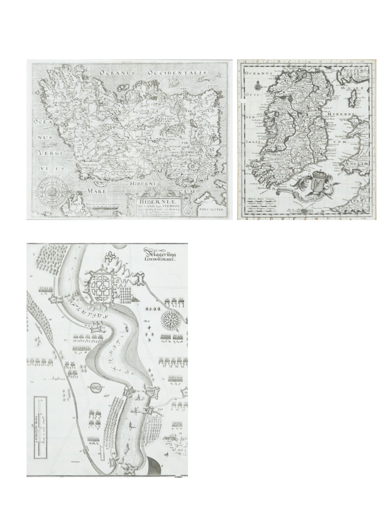
13 MATTHÄUS MERIAN (1621-1687)A Battle Plan of the Siege of Londonderry
(1689). 260 x 350.
€ 80 - 120
12 JOHANN CHRISTOPH BEER (1665-1695)A Map of Ireland
From Neu Geharnischte Gross Britannien. 250 x 295; together with ATown Plan of
Dublin. 130 x 160. Published Nuremberg in 1690. Abl 30. (2)
€ 250 - 350
11 WILLIAM HOLE (FL. 1607-1646)Hiberniæ
From Camden’s Britannia. Eigth edition (1837). Based on Mercator’s map (1595).
Abl P238.
€ 150 - 250