


 26 / 114

Wednesday 26th April
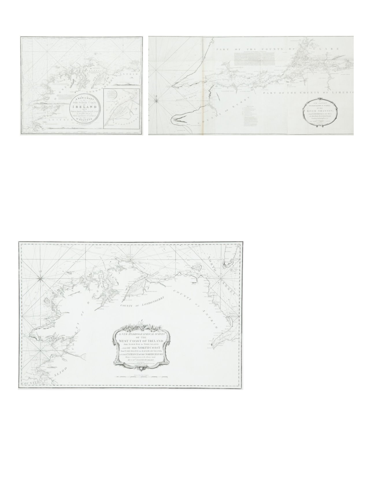
37 WILLIAM HEATHER IVChart of the North Coast of Ireland
The title is in a circular frame in the centre and reads “A New
Chart OfThe North Coast of Ireland From Sligo Bay to Rachlin Isle
Drawn FromThe Latest Surveys forW. Heather.
780 x 645 mm
€ 100 - 200
38 HUDDARTChart of the Shannon Estuary
The title is in an oval frame in the lower right corner and reads “A New and Exact
Hydrographical Survey of the River Shannon; from Limerick to the Sea, with all the
Banks, Shoals, Rocks, Channels, Soun dings,Anchoring Places, &c.”Within the frame
also is a “Scale ofTwo Leagues or Six Miles 6 [= 142 mm.]” and the imprint “London.
Printed for Robt. Sayer and John Bennett, Fleet Street, as the Act directs 14 April
1781”.
Sayer and J. Bennett, No. 53 Fleet Street, as the Act directs 14 April 1781”. 1,560 x
725 mm.
€ 200 - 400
39 HUDDARTChart of the North Coast of Ireland
The title is a scalloped frame in the bottom centre and reads “A New Hydrographical Survey of theWest Coast of Ireland from Sligo Bay toTory Island and of the North Coast fromTory
Island to Raughlan Island; with the Entrance of the North Channel Being a Continuation of the Survey made by Captn. Joseph Huddart. London. Printed for R. Sayer & J. Bennett, Fleet
Street, as the Act directs 19 Septr. 1781”.
This chart was first published in 1781 by Sayer and Bennett and was included in their East India Pilot of that year. It was reprinted in 1794 by Laurie andWhittle for their Irish Coasting
Pilot and Coasting Pilot of Great Britain and Ireland. It was reprinted again in 1812 and in this form was included as the fifth chart in Laurie andWhittle’sThe North-about Navigator of
1818. 795 x 525 mm.
€ 200 - 400