


 171 / 259

171
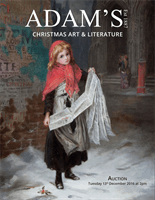
214 JOHANNES VAN KEULEN (C. 1654-1715)A Chart of the West Coast of Ireland (1702)
“Paskaart Vande West Cust van Yrland Beginninde van Klady Tot aen Blasques,
Met alle zyn Diepte en Droogte Dus ver Naaukeurig oppgestelt en van veel fouten
verbetert. Ao. 1681.” And separately “T`Amsterdam, By Johannes van Keulen
Boeck verkooper aen de Nieubrughe in de gekroonde Loots-man. Met Priviligie
voor 15 Iaar.” This is the second state of this chart with nautical details added
along the Shannon including the name “Casteel van Carigenel” opposite Limerick.
From De Nieuwe Groote Lichtende Zee-Fakkel (1702). Verso blank. 580 x 510.
Provenance: The Richard S.J. Clarke Collection
€ 100 - 200
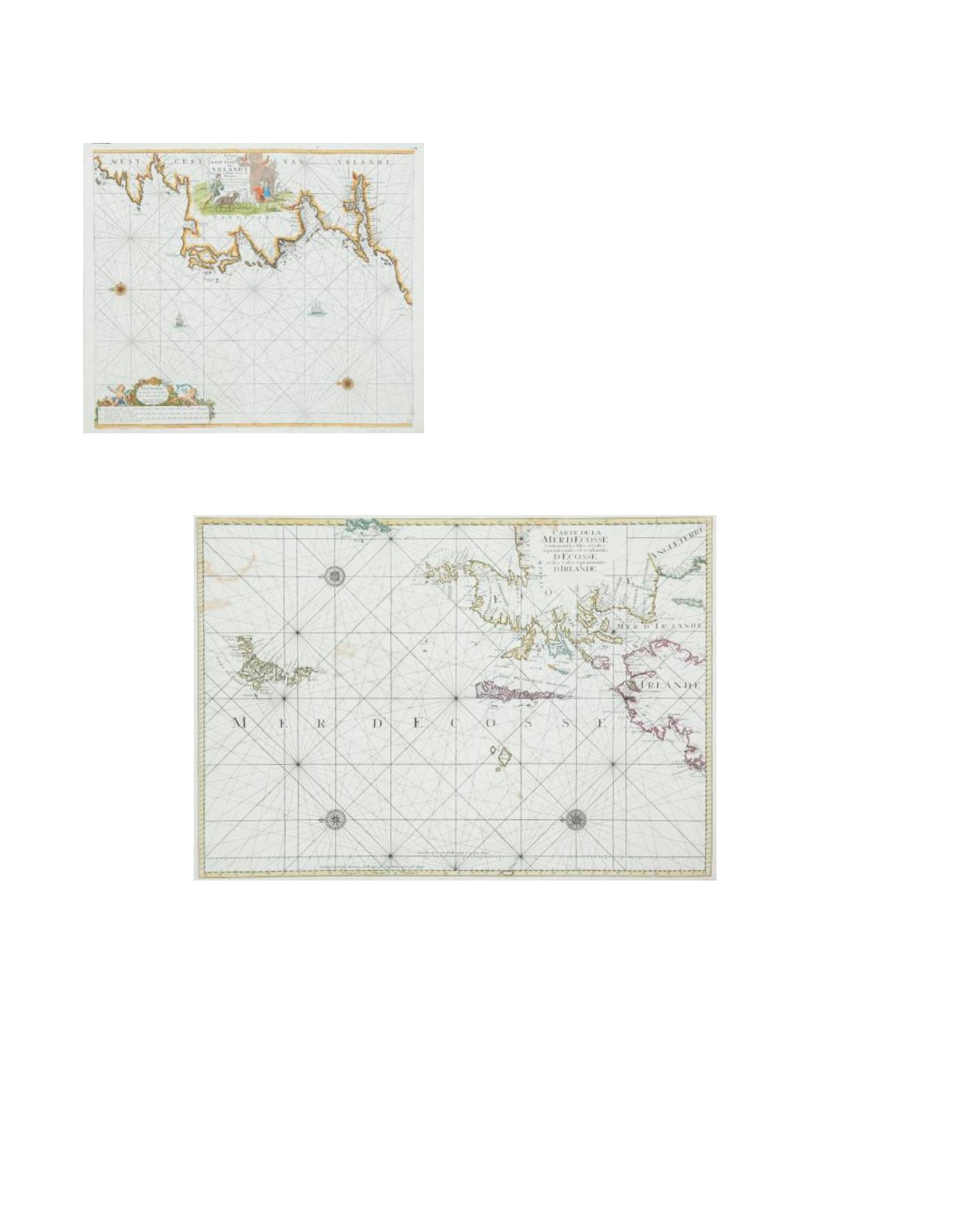
215 MORTIER, PIETER (1661-1711)Bookseller and printer, of Amsterdam, but educated in Paris and with strong French connections. He published in collaboration with Hubert Jaillot of Paris, his
own version of Pene`s Le Neptune Francois in 1693 and, in fact, it was much more successful in terms of sales. His daughter Agatha Amelia Mortier married
Johannes Covens who took over the business under the name of Covens and Mortier. He published the same three Irish maps as Pene, but with new plates and
many minor differences, particularly the absence of the BYCOLOMBIER watermark.
A Chart of Northern Ireland and Scotland (1693)
“Carte de la Mer d`Ecosse Contenant les Isles et Costes Septentrionales et Occidentales d`Ecosse et les Costes Septentrionales d`Irlande.” From Le Neptune
Francois (1693). The title is the same as on Pene`s chart and differences are small, but the clearest is that in this version the apostrophe of “D`ECOSSE” in the
centre is 3 mm long and fatter, compared with a slender 6 mm in Pene`s edition. Verso blank. 860 x 590.
Provenance: The Richard S.J. Clarke Collection
€ 120 - 160