


 146 / 244

146
info@adams.ie576
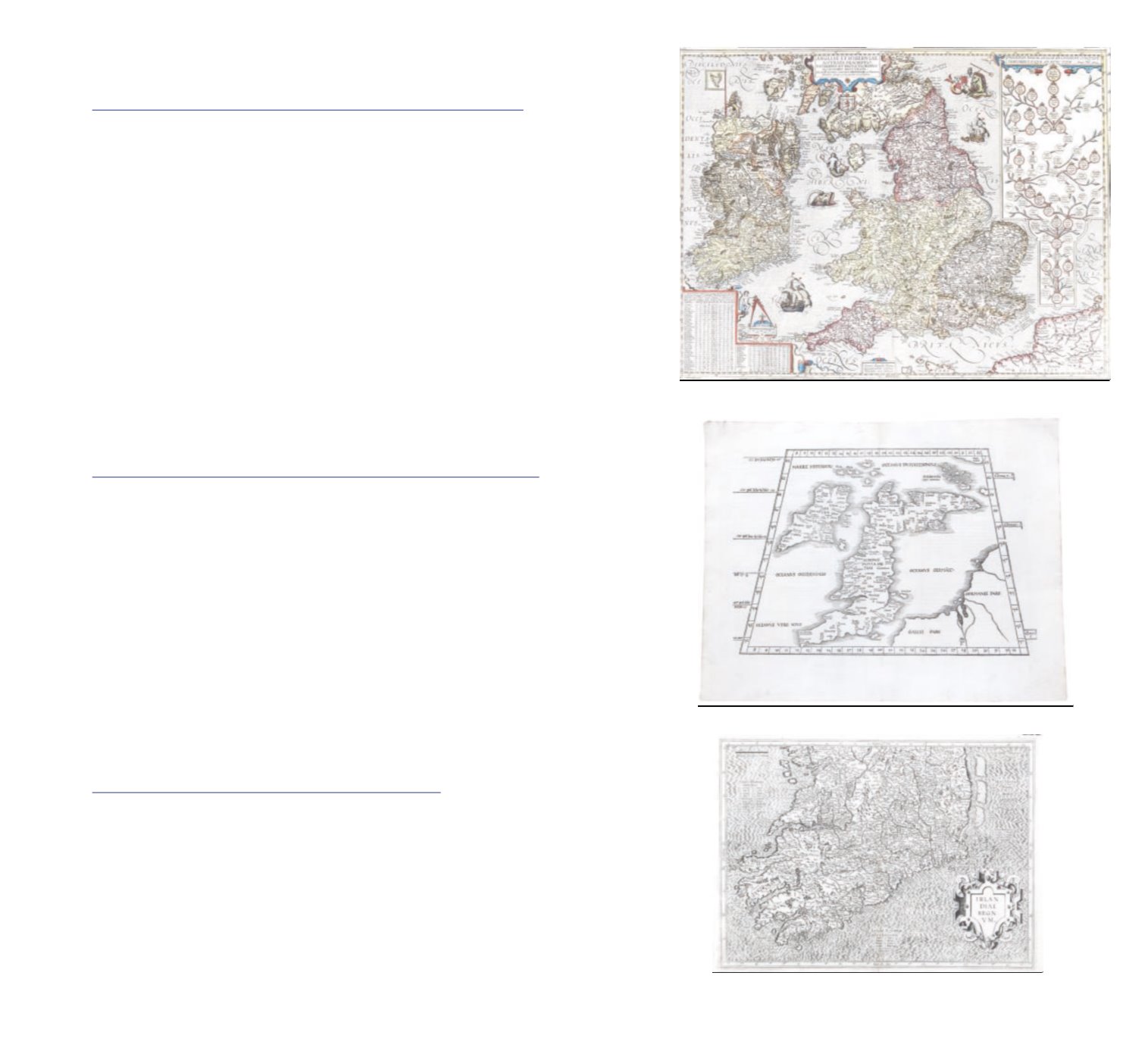
JOHANNES BAPTISTA VRINTS, 1574-1610, ANTWERP
A map of the British Ilses with a family tree of the Kings and Queens of England from William I
1066 to James I of England “Anglar et Hiberniæ accucata descriptio veteribus et recent ioribus
nominibus illustrata.
coloured engraving, 450 x 590mm
€600 - €800
577
ATTRIBUTED TO MARTIN WALDSEEMULLER, 1470-1520
the compiler of the early Ptolemy’s Geographia.
This state was published in Strasburg 1525,
Shirley 17
410 x 295mm
€850 - €900
578
GERARD MEMCATOR, 1512-1594
Irlandiae Regnum
the southern half of the country From the “Atlas sive cosmographiccae meditationes de fabrica
mundi er fabricaiti figura” Engraving.
380 x 500mm (sheet)
€200 - €400